maps
Maps of Norwold
Maps of Norwold
Norwold is unusually well-mapped by its fan community. This page catalogs the maps worth having, with local copies of the core fan maps (freely shared for personal use, each attributed) and links to the far larger collections on the Atlas of Mystara and the Vaults of Pandius. Full credit is on the Attribution page.
On what is copied and what is linked. The files below are original fan works published on the Vaults for personal use; they are copied here for offline table use with their authors named. The Atlas of Mystara renders and the canon-replica maps are closer derivatives of published products, so they are linked, not copied. No TSR/WotC module scans are hosted here.
Local copies (downloaded for offline use)
Region and political
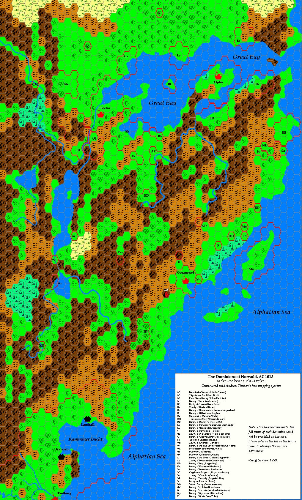
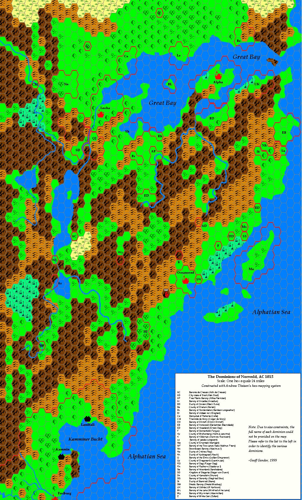
- The Dominions of Norwold, AC 1015, Geoff Gander. The political map that
matches the ruler roster in Realms.
View · source Vaults
Local and city maps
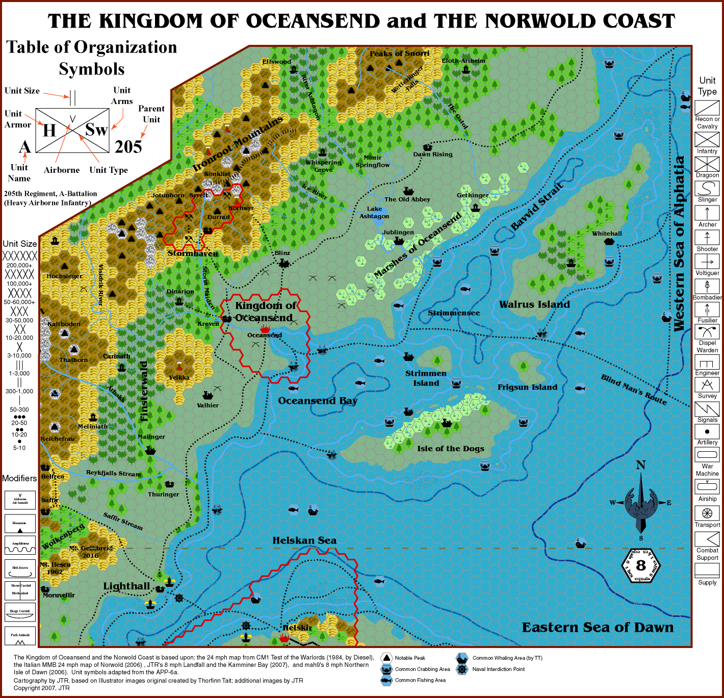
- Oceansend and the Norwold Coast, JTR. View · source
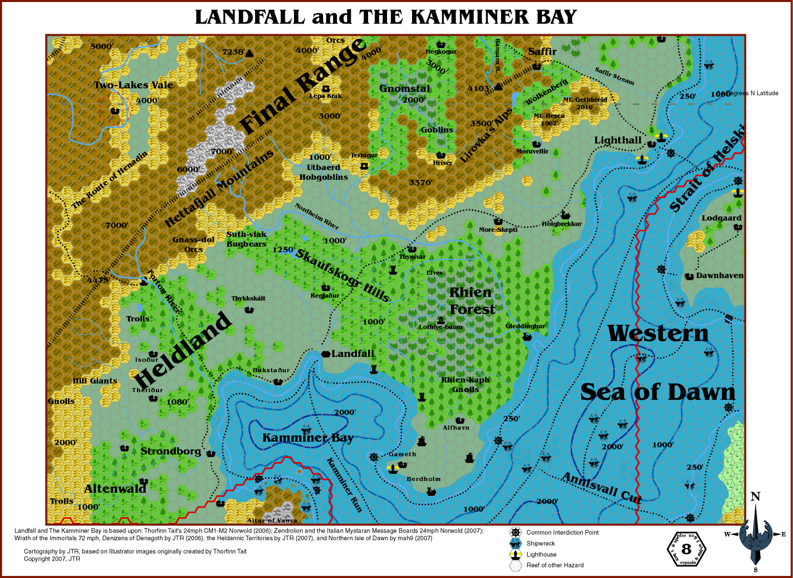
- Landfall and Kamminer Bay, JTR. View · source
- The Streets of Landfall, JTR. View · source
- Leehashire, Dan Eustace. View · source
- The Arch of Fire region (8 mi/hex), Robin. View · source
- The Skaufskogr region, Giampaolo Agosta (Agathokles). View · source


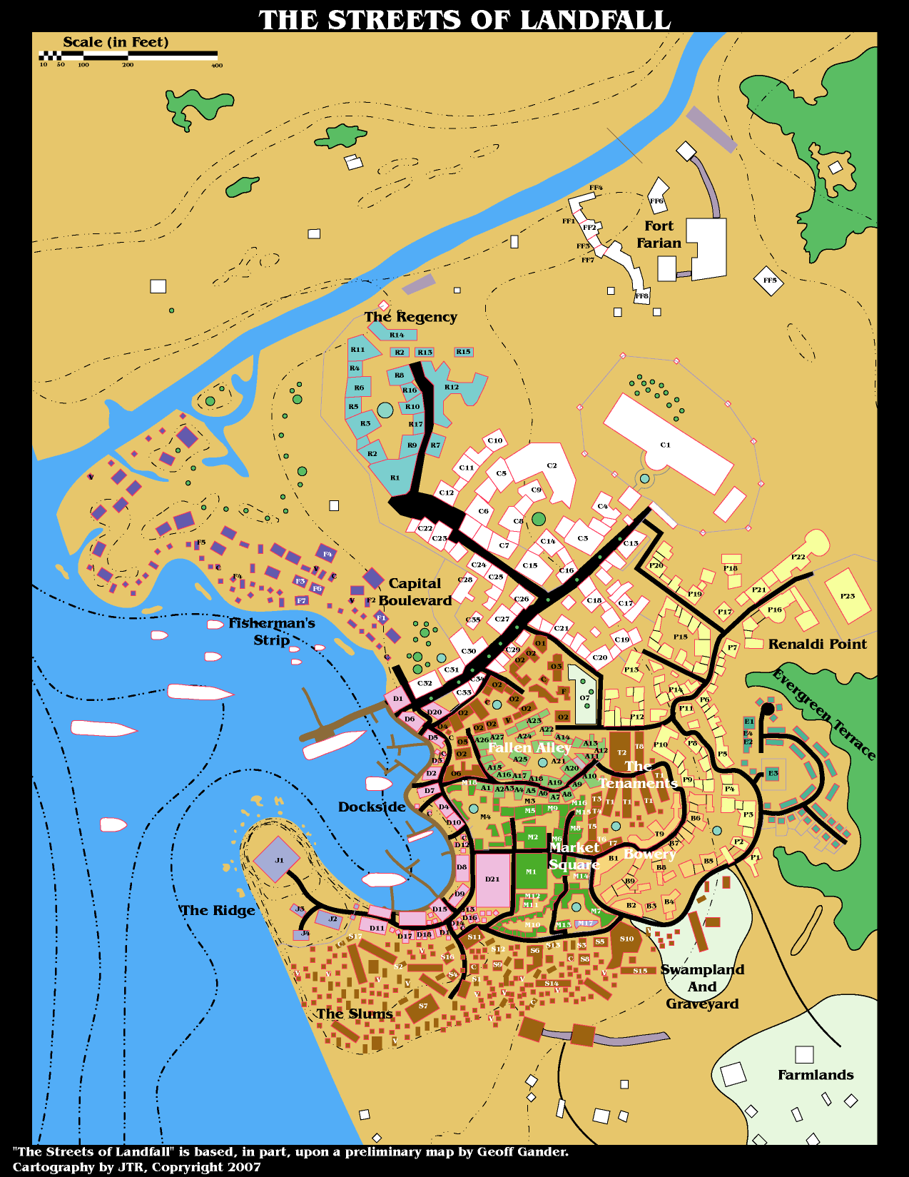

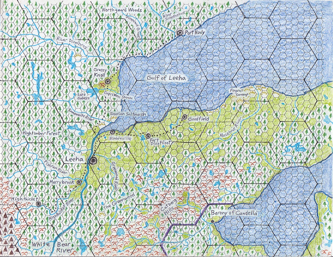

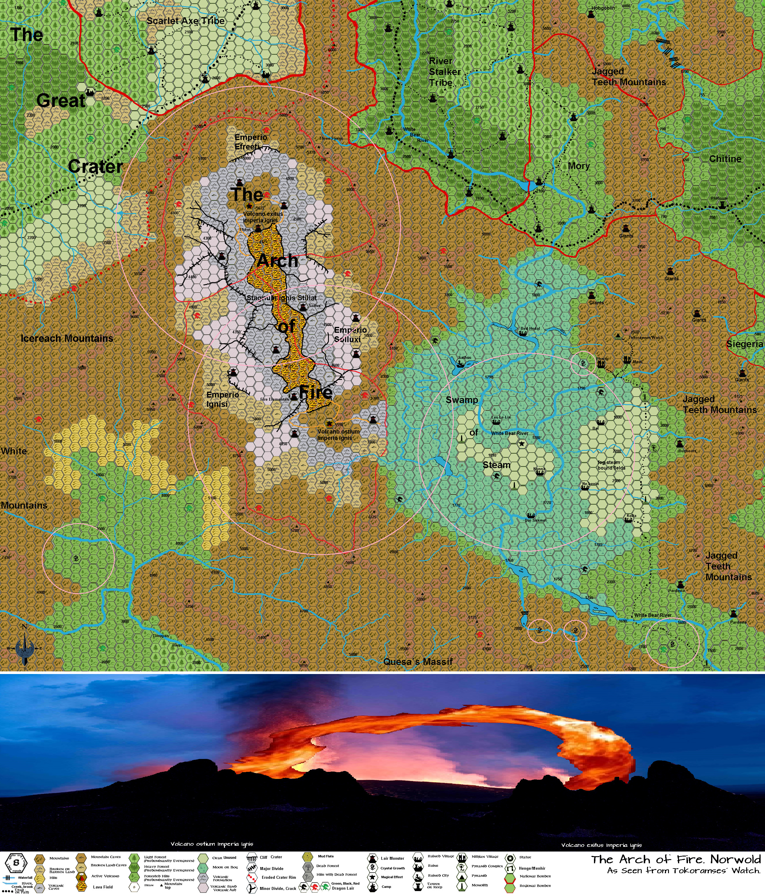

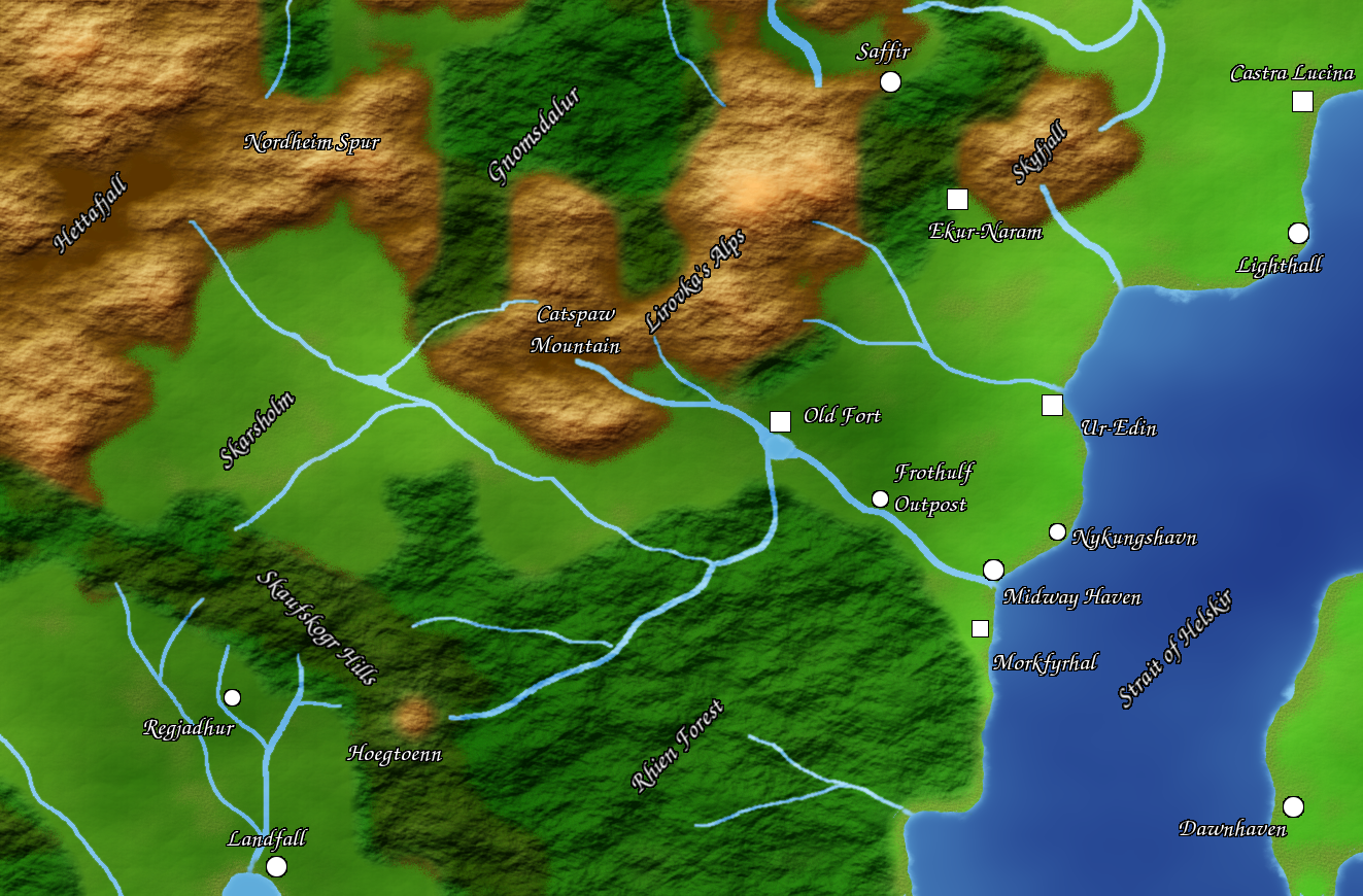

Linked, the Atlas of Mystara (Thorfinn Tait and contributors)
The Atlas holds the definitive fan cartography of Norwold. The most useful for an Almanac-era campaign:
- Zendrolion’s Norwold, 24 mi/hex (Simone Neri), the master political maps: v1.7 · v1.5 Political
- Zendrolion’s Norwold Domains v3, the dominion borders.
- Zendrolion’s Norwold Ethnographical v2, the peoples, matching Peoples.
- Zendrolion’s Lower Norwold, 8 mi/hex (WIP), detail map.
- The full Atlas Norwold set, the index at the Vaults Norwold page links every version; browse the Atlas at https://atlasofmystara.com/ and https://mystara.thorfmaps.com/.
Linked, canon-replica maps (fan reconstructions of published maps)
Thorfinn Tait’s replicas of the original module maps, useful for canon fidelity:
- Norwold, 24 mi/hex (CM1 replica)
- Norwold, 24 mi/hex (M2 replica, DM’s and Players’ maps)
- Twolakes Vale, 1 mi/square (CM2 replica)
- Dominion of Vyolstagrad, 2 mi/hex (CM4 replica)
- Known World, 150 mi/hex (M4 replica, Norwold in context)
Linked, more local and fan maps on the Vaults
- Robin’s Composite Map of Norwold, https://pandius.com/nwldcmp.html
- JTR’s Ransarn-Vinisk Valley (beta), https://pandius.com/ransarn.html
- Matthew Fleet’s Northern Norwold (24 mi/hex), https://pandius.com/nnorwold.html
- Cab Davidson’s Maganshire and the City of Magan, AC 1057, https://pandius.com/Maganshire6.jpg
- Idilio Santos’s Rhien Forest, Landfall Region, and Saffir maps, and Andrea Francolini’s AC 1160 campaign maps, all indexed at the Vaults Norwold page.

For the larger fan gazetteers (text), see the downloaded PDFs linked from Sources.